
Page 4 - Demo
P. 4
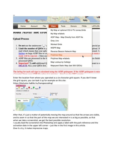
%ufffcEnter the location from where you operated as a six character grid square. If you don%u2019t know the grid square, you can look it up for example on this site: https://dxcluster.ha8tks.hu/hamgeocoding/%ufffcAfter that, it%u2019s just a matter of potentially moving the map around so that the arrows are visible, and to zoom in so that the part of the map we are interested in is as big as possible, so that when we take a screenshot, we get the best possible resolution.I usually load the screenshot into Photoshop and apply a label with the park reference and the activation date in the upper left corner %u2013 just like in the first image in this article. Give it a try, it makes impressive maps.
